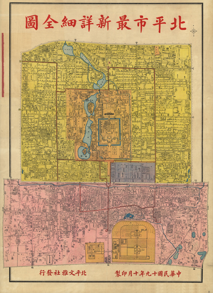
Date: 1930
Illustration: The Latest Detailed Map of Beiping City
Original archiving department: Department of Land Administration
Description: Precious maps leave detailed records of lives and landscapes underneath a certain historical backdrop. Since the Liao, Jin, Yuan, Ming, and Qing dynasties and the People’s Republic of China, the capitol has been set in Beijing with enclosing walls built around the city during the Jiajing reign. The overall street arrangement has reflected the traditional ideas of patriarchal etiquette. In June of 1930, Beiping was elevated to the provincial city of Hebei province and was upgraded to be a Yuan-administered city in December. The adjustment of this administrative division shows the political turbulence of the time. This map not only displays the city arrangements of Beijing but also its rich historical legacy.
 A Slice of Wonder