


TELDAP Collections
 A Slice of Wonder
Facets of Taiwan
Exhibitions
| Taiwan Aerial Imaging |
|
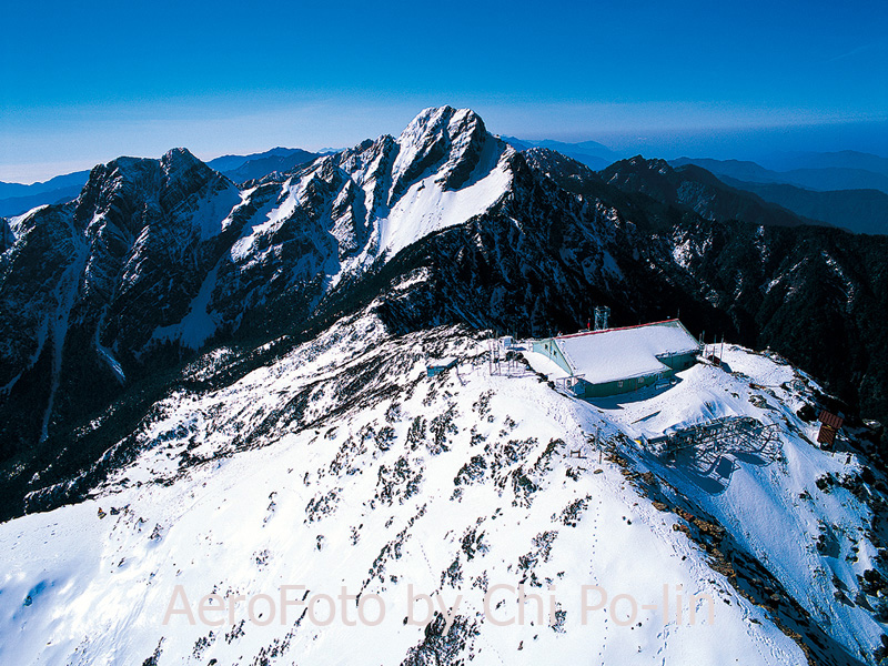
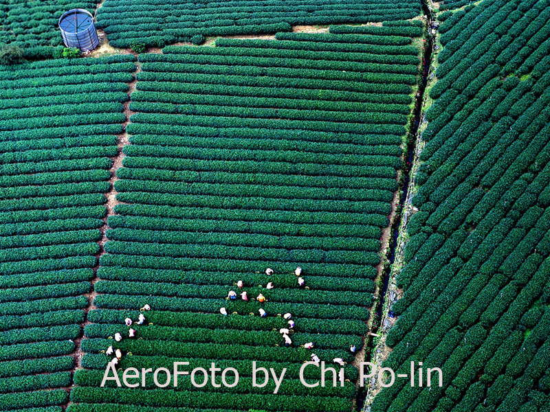
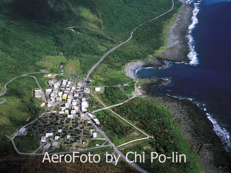
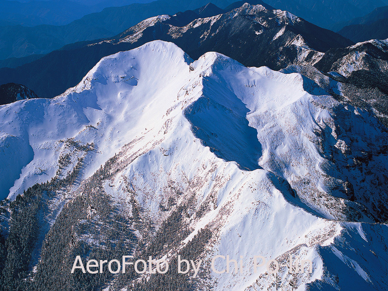
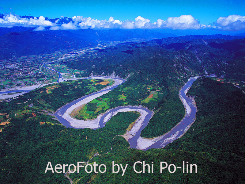
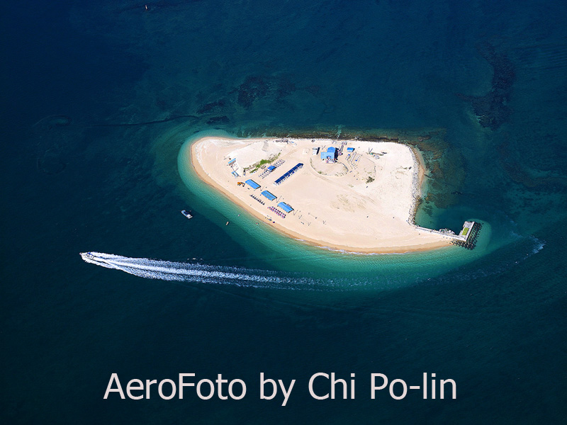
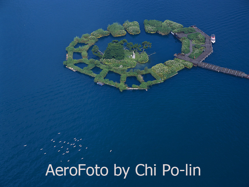
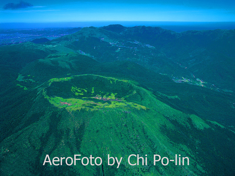
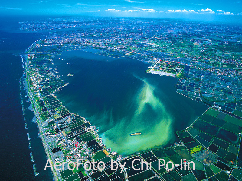
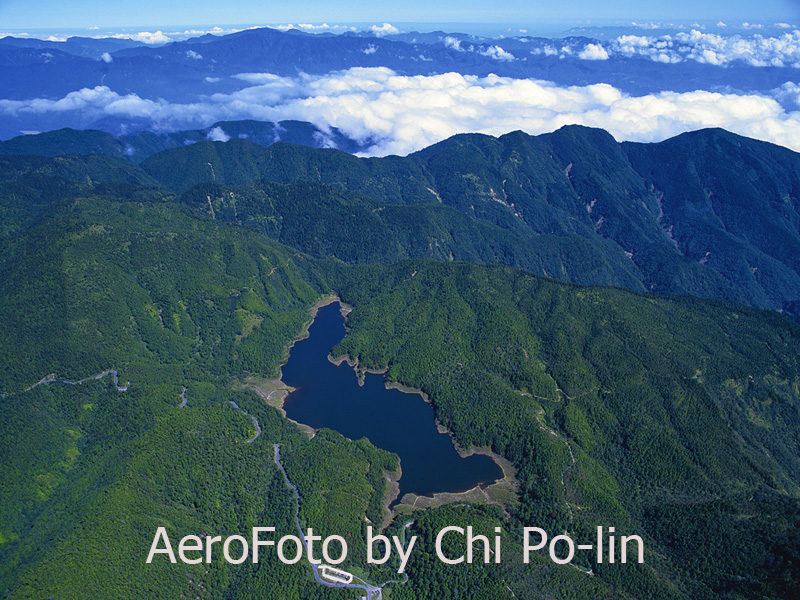
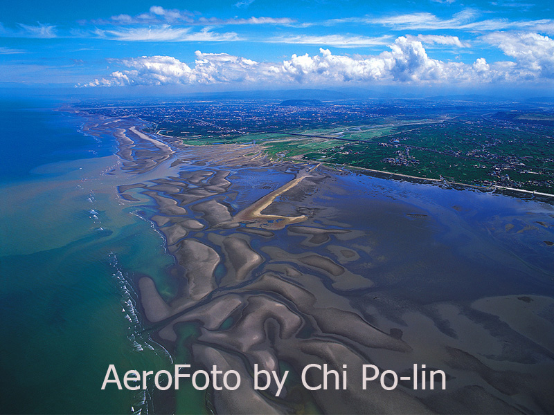
Located where the Eurasian Plate and Philippine Plate converge, on the eastern edge of the Asian continent, Taiwan is an island of enchanting scenic beauty with majestic mountains, rolling hills, tranquil flatlands, shimmering lakes, and exquisite beaches. Forested mountains cover two-thirds of the total area. There is the Central Mountain Range which runs from the north of the island to the south. To its west side lies the Yushan Range. The Yushan main peak, rising 3952 meters above sea level, is the highest mountain peak in Northeast Asia. Taiwan also has many offshore islands such as Penghu and Lanyu. Due to limitations of human vision, often times we see only a small part of scenery. When the great poet Su Shi toured Lu-shan (Lu Mountain) in the 7th year of the Song Dynasty’s Yuan-feng period (1084), he remarked, “From the front, a whole range; from the side, a single peak. Far, near, high, low-no two parts alike. I can't tell the true shape of Lu-shan because I myself am on the mountain.” If Su Shi had a bird’s eye view of Lu-shan, would he have comprehended it differently? Chi Po-lin, a Taiwanese photographer, looks at Taiwan from helicopters. His work, the “Taiwan Aerial Imaging” series, let us view the multi-faceted Taiwan from yet another angle and offer us a new appreciation of the landscapes of Taiwan, this beautiful Formosa! Confucius once said, "The benevolent enjoy the mountains, the wise enjoy the waters.” Whether we prefer mountains or waters, Taiwan’s magnificent scenery shown in these pictures and videos can broaden our experience and increase our appreciation of the land.
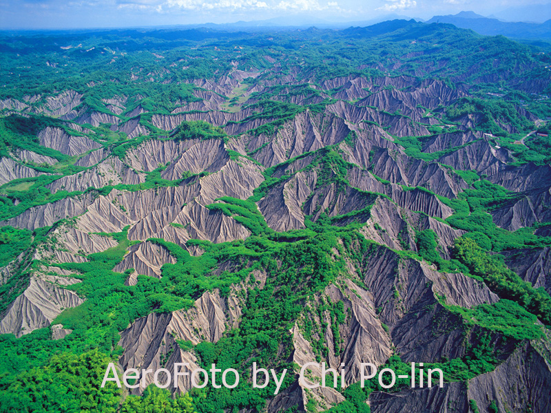
Aerial photography, in addition to being a work of art, can record big natural and human activities. Earthquakes and typhoons can dramatically alter landscapes. In recent years, the world has seen many environmental changes. Taiwan is no exception and has experienced several tragic natural disasters such as the 921 earthquake in 1999. Before the quake, the Jiujiu Peak (99 Peaks) in Nantou was covered with lush green vegetation. After the quake, many of its ridges were shaved and mountain tops leveled. Its exposed rocky tops, stripped of vegetation, were captured in the video "Sun Moon Lake." Human activities such as dams, roads, and developments affect landscape elements even more. As Taiwan pursued economic success, it inadvertently sacrificed its environment. Chi Po-lin once said, "After recording for a long period of time, I find that the rate of my taking pictures is always behind the speed with which the land is being developed. Every time I look down from the air, I lament the power and cruelty we damage our land.” He also said, “What an aerial photographer can do is to take a snap shot of the unique shape or wonderful colors of a particular landscape, as historical witness to the land."
Video(QuickTime required)
When we view these aerial works and admire the beauty of them, perhaps we will change the way how we see things and wish to reduce our impact on the geographical and ecological environment. When we develop a piece of land, perhaps we will take other factors into account and try to diminish the damage to the environmental resources. We have to achieve a balance between developing and protecting the land so that Taiwan can stay Ilha Formosa forever.
|


 visits (since January 2011)