Date: 1949
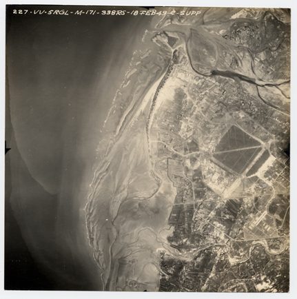
Illustration: Old Aerial Photo of Xinzhu Area
Original archiving department: Energy and Environment Research Laboratories, Industrial Technology Research Institute
Description: The shape of the Xinzhu airport is revealed to be just like that of a baseball field—a quadrilateral. The holes left by bombing on the runway can still be seen clearly in the photo, and parked in the airport are many transport planes and bombers that are bound for the People’s Republic of China. Toucian river in the north and Keya river in the south were not yet straightened in the photo. There has been a tremendous transformation in the landscape of the whole area.
 A Slice of Wonder