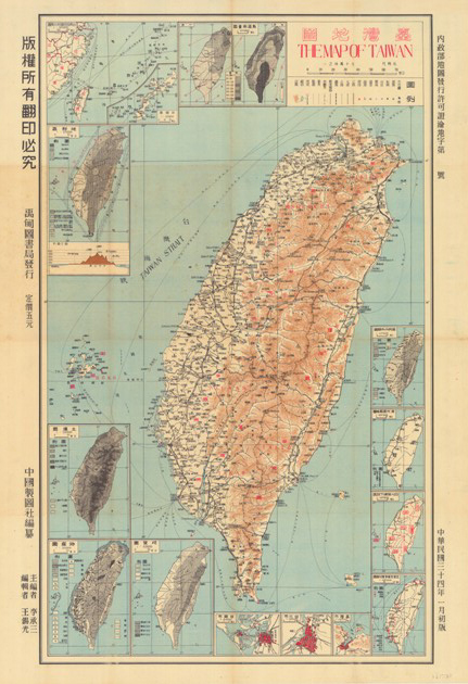
Date: 1945
Illustration: Map of Taiwan
Scale: 1/700,000
Original archiving department: Department of Land Administration
Description: This map records administrative borders, villages, transportation, mountain ranges, and rivers, providing information for understanding different facets of Taiwan, like the climate, geology, soil, topography, military affairs, commodities, and distribution of different ethnic groups.
 A Slice of Wonder