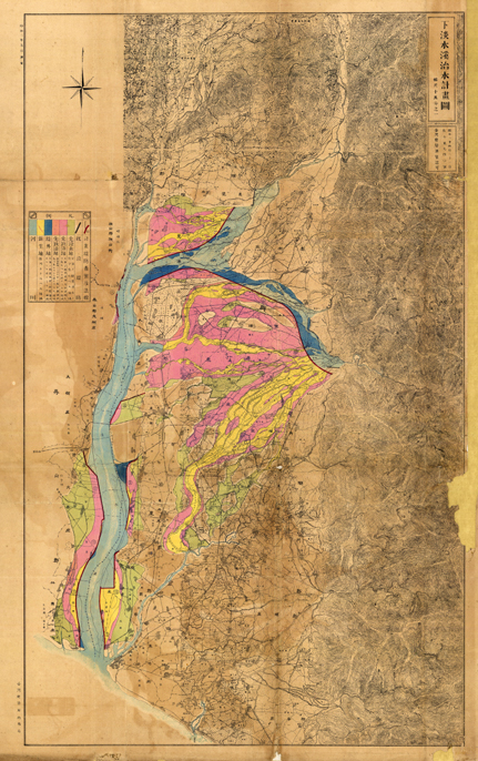
Date: 1927
Illustration: The Gaoping River Remediation Map
Scale: 1/100,000
Original archiving department: Water Resources Agency, Ministry of Economic Affairs
Description: This map exhibits the Japanese colonial government’s remediation project of the Gaoping river. The embankment construction project altered the original river route which reduced the frequency of flooding, creating a significant impact on the utilization of lands in the Pingtung area in modern times and on the distribution of villages.
 A Slice of Wonder